A new independent GLOBAL rainfall product from ASCAT soil moisture observations through SM2RAIN
Funded by EUMETSAT
Period: 01/11/2017 – 31/12/2020![]()
Partners: The consortium is leaded by CNR-IRPI with the collaboration of Vienna University of Technology, Department of Geodesy and Geoinformation
Description: Accurate rainfall estimates are of paramount importance as rainfall plays a key-role in many fields as, to cite a few, natural hazard assessment (floods and landslides), drought management, weather forecasting, agriculture and diseases prevention. State-of-the-art rainfall products obtained by satellites are often the only way for measuring rainfall in remote areas of the world.
The main objectives of GLOBAL SM2RAIN project are to generate a new global scale and high resolution satellite rainfall product obtained by ASCAT and to prepare for a potential operational implementation in the EUMETSAT H SAF framework, complementing the currently planned H SAF SM2RAIN activities but on a global scale. The expectation is that this product will improve the accuracy over land with respect to state-of-the-art satellite products and the performance of operational tools for flood, drought and landslide hazard assessment and mitigation.
A global daily rainfall dataset has been obtained in the GLOBAL SM2RAIN project:
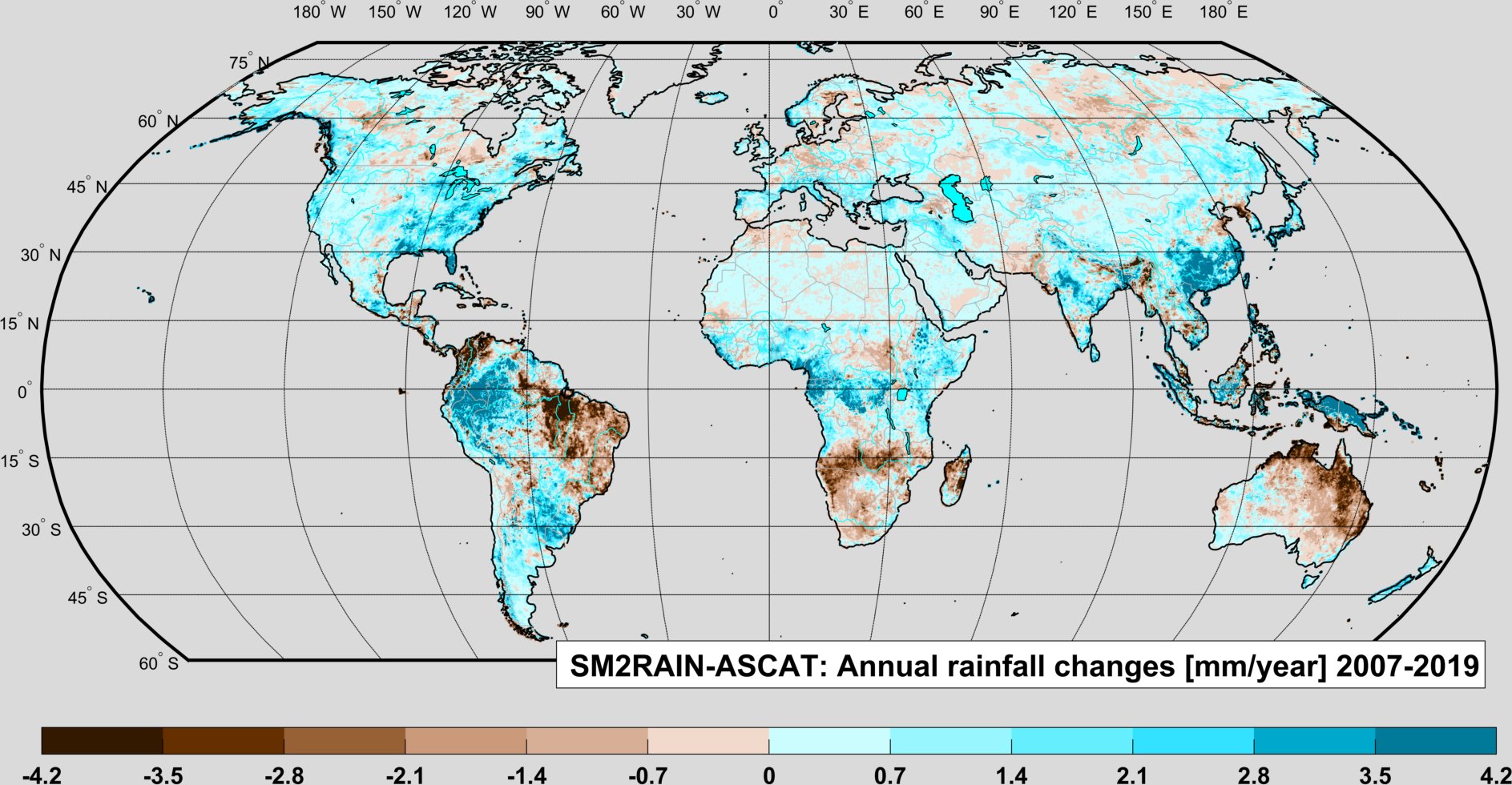
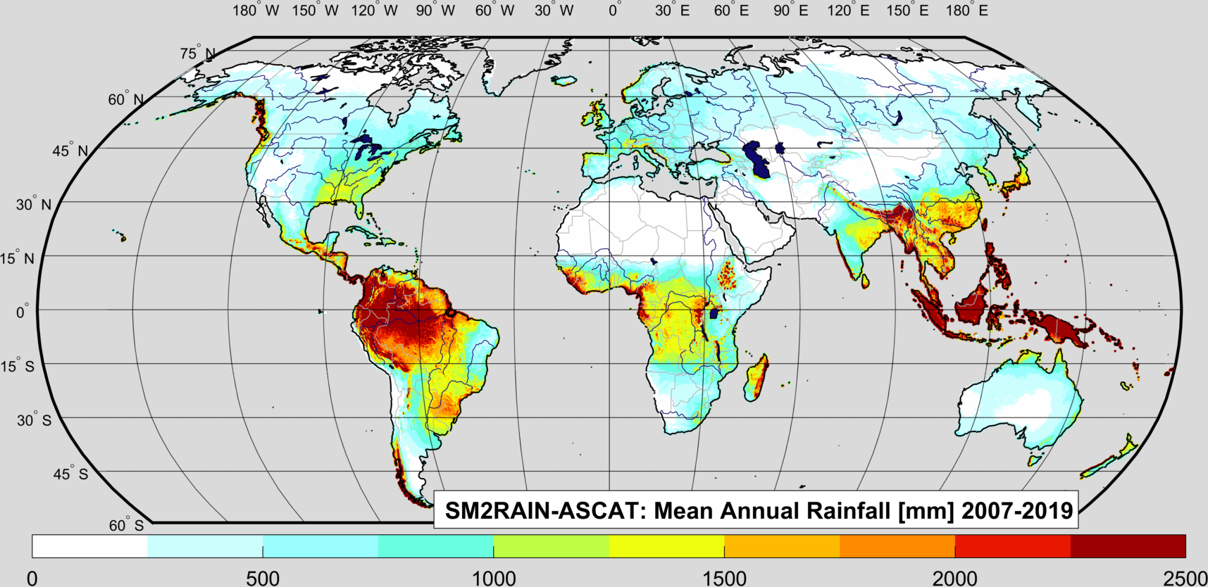
SM2RAIN-ASCAT
NetCDF: https://doi.org/10.5281/zenodo.2591214
GeoTIFF: https://doi.org/10.5281/zenodo.3520620
Time coverage: 2007-2019. Spatial\temporal resolution: 12.5 km\1-day.
Brocca, L., Filippucci, P., Hahn, S., Ciabatta, L., Massari, C., Camici, S., Schüller, L., Bojkov, B., Wagner, W. (2019). SM2RAIN-ASCAT (2007-2018): global daily satellite rainfall from ASCAT soil moisture. Earth System Science Data, 11, 1583–1601, doi:10.5194/essd-11-1583-2019. https://doi.org/10.5194/essd-11-1583-2019.
Press: BLOG Natural Hazards, ISMC
🆕 We are very happy to announce the release of the updated version of our global 🛰️ #rainfall #SM2RAIN-ASCAT dataset until the end of August 2019
🔗https://t.co/VxZ99iF1VU
Animation shows global rainfall for 2019 in 24sec!
Thanks🙏 @eumetsat @CopernicusEMS @CopernicusEU @ESA_EO pic.twitter.com/GWFNu8BUSc— Hydrology IRPI-CNR (@Hydrology_IRPI) September 13, 2019