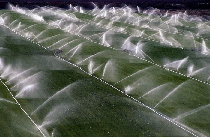
 Feeding a growing global population is a major concern, but efforts to grow more food will place an added burden on precious supplies of freshwater. We have developed a new approach for using measurements of soil moisture from space to understand how much water is used for agriculture and potentially help farmers manage consumption.
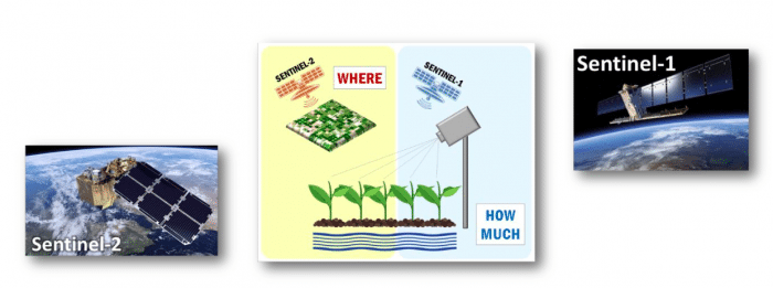
We now plan to extend the study to explore the potential offered by the high-resolution data from the new Copernicus mission, Sentinel-1, jointly with the very high-resolution optical observations from Sentinel-2.
Including Sentinel missions in our study may change the spatial and temporal scales at which we can observe irrigation from space. I am guessing that with more research these new high-resolution products will be a game changer in the near future to advance our capacity to better monitor irrigation over agricultural lands.
We have already published the first paper outlining our approach:
“How much water is used for irrigation? A new approach exploiting coarse resolution satellite soil moisture products” International Journal of Applied Earth Observation and Geoinformation
by L. Brocca, A. Tarpanelli, P. Filippucci W. Dorigo F. Zaussinger, A. Gruber and D. Fernández-Prieto
We have also raised the interest of MEDIA in the ESA website, the Science Trends and we give an interview (in Italian) for “Economia Cristiana“.
We have won the “BayWa Smart Farming Challenge” at 2018 COPERNICUS MASTER for the idea “SPACE-IRR – How Much Water for Irrigation?”

We are currently running the ESA funded IRRIGATION* project to develop and validate advanced Earth Observation-based algorithms and techniques for irrigation mapping, quantification and detection of seasonal timing of irrigation from field to regional/global scale.
Almost 7 years (Jan. 2011 – Sep. 2017) of estimated #irrigation from space, obtained by exploiting #SMOS and #SMAP downscaled soil moisture at 1 km. 🛰️💧
Soon the paper describing the details of the method (hopefully 🤞).@Hydrology_IRPI @UniperugiaNews @obsebre @isardSAT pic.twitter.com/bTil52u6cs— Jacopo Dari (@jacopo_dari) July 2, 2020
Here the list of papers published (submitted) so far showing how to use of soil moisture for irrigation quantification and detection:
- Brocca, L., Tarpanelli, A., Filippucci, P., Dorigo, W., Zaussinger, F., Gruber, A., Fernández-Prieto, D. (2018). How much water is used for irrigation? A new approach exploiting coarse resolution satellite soil moisture products. International Journal of Applied Earth Observation and Geoinformation, 73C, 752-766, doi:10.1016/j.jag.2018.08.023. https://doi.org/10.1016/j.jag.2018.08.023.
- Dari, J., Quintana-Seguí, P., Escorihuela, M.J., Stefan, V., Brocca, L., Morbidelli, R. (2021). Detecting and mapping irrigated areas in a Mediterranean environment by using remote sensing soil moisture and a land surface model. Journal of Hydrology, 56, 126129, doi:10.1016/j.jhydrol.2021.126129. https://doi.org/10.1016/j.jhydrol.2021.126129.
- Dari, J., Brocca, L., Quintana-Seguí, P., Escorihuela, M.J., Stefan, V., Morbidelli, R. (2020). Exploiting high-resolution remote sensing soil moisture to estimate irrigation water amounts over a Mediterranean region. Remote Sensing, 12(16), 2593, doi:10.3390/rs12162593. https://doi.org/10.3390/rs12162593.
- Filippucci, P., Tarpanelli, A., Massari, C., Serafini, A., Strati, V., Alberi, M., Raptis, K.G.C., Mantovani, F., Brocca, L. (2020). Soil moisture as a potential variable for tracking and quantifying irrigation: a case study with proximal gamma-ray spectroscopy data. Advances in Water Resources, 136, 103502, doi:10.1016/j.advwatres.2019.103502. https://doi.org/10.1016/j.advwatres.2019.103502.
- Jalilvand, E., Tajrishy, M., Hashemi, S.A.G., Brocca, L. (2019). Quantification of irrigation water using remote sensing of soil moisture in a semi-arid region. Remote Sensing of Environment, 231, 111226, doi:10.1016/j.rse.2019.111226. https://doi.org/10.1016/j.rse.2019.111226.
- Zaussinger, F., Dorigo, W., Gruber, A., Tarpanelli, A., Filippucci, P., Brocca, L. (2019). Estimating irrigation water use over the contiguous United States by combining satellite and reanalysis soil moisture data. Hydrology and Earth System Sciences, 23, 897-923, doi:10.5194/hess-23-897-2019. https://doi.org/10.5194/hess-23-897-2019.
- Modanesi, S., Massari, C., Camici, S., Brocca, L., Amarnath, G. (2020). Do satellite surface soil moisture observations better retain information about crop-yield variability in drought conditions? Water Resources Research, in press, doi:10.1029/2019WR025855 https://doi.org/10.1029/2019WR025855.
- Dari, J., Quintana-Seguí, P., Escorihuela, M.J., Stefan, V., Brocca, L., Morbidelli, R. (…). Detecting and mapping irrigated areas in a Mediterranean environment by using remote sensing soil moisture and a land surface model. submitted to Remote Sensing of Environment.
- Brocca, L., Ciabatta, L., Massari, C., Camici, S., Tarpanelli, A. (2017). Soil moisture for hydrological applications: open questions and new opportunities. Water, 9(2), 140.
- Dari, J., Brocca, L., Quintana-Seguí, P., Casadei, S., Escorihuela, M.J., Stefan, V., Morbidelli, R. (…). Double-scale analysis on the detectability of irrigation signals from remote sensing soil moisture over an area with complex topography in central Italy. submitted to Advances in Water Resources.
Contacts:
luca.brocca@irpi.cnr.it
angelica.tarpanelli@irpi.cnr.it
sara.modanesi@irpi.cnr.it
christian.massari@irpi.cnr.it
paolo.filippucci@irpi.cnr.it